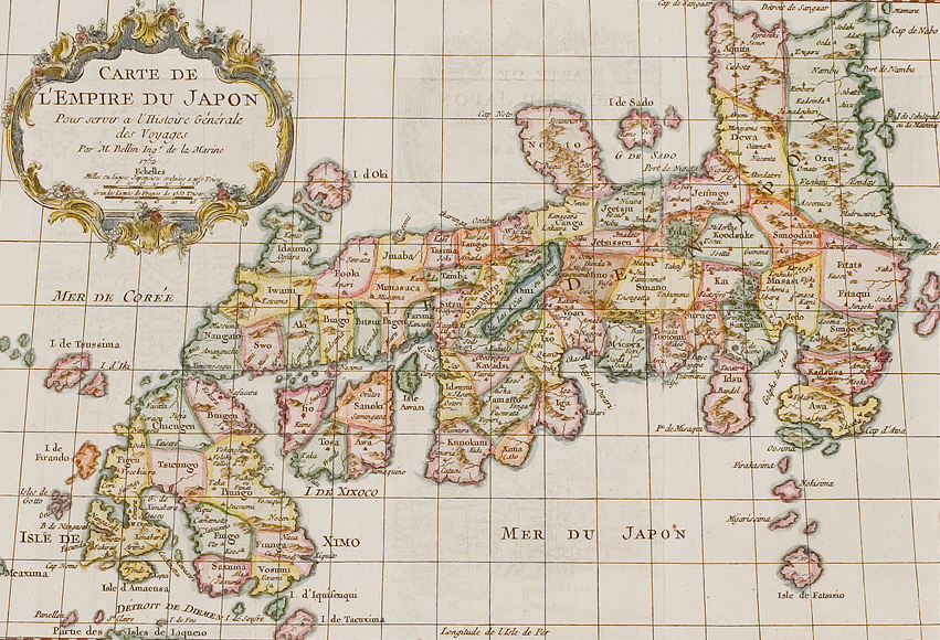
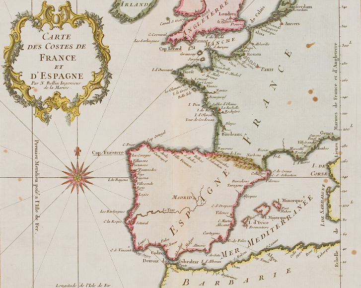
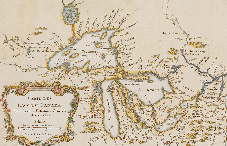
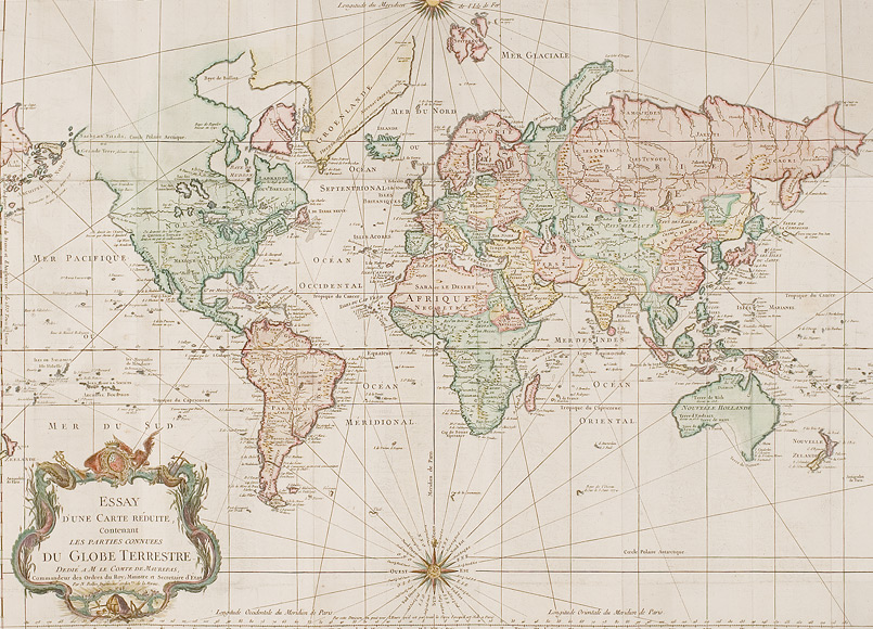
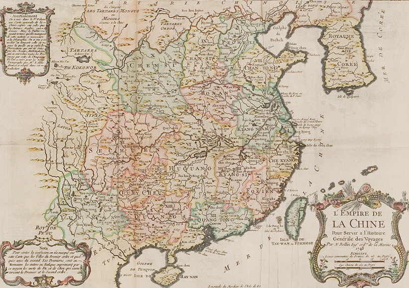
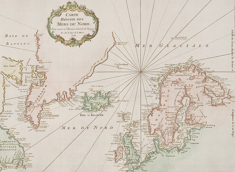
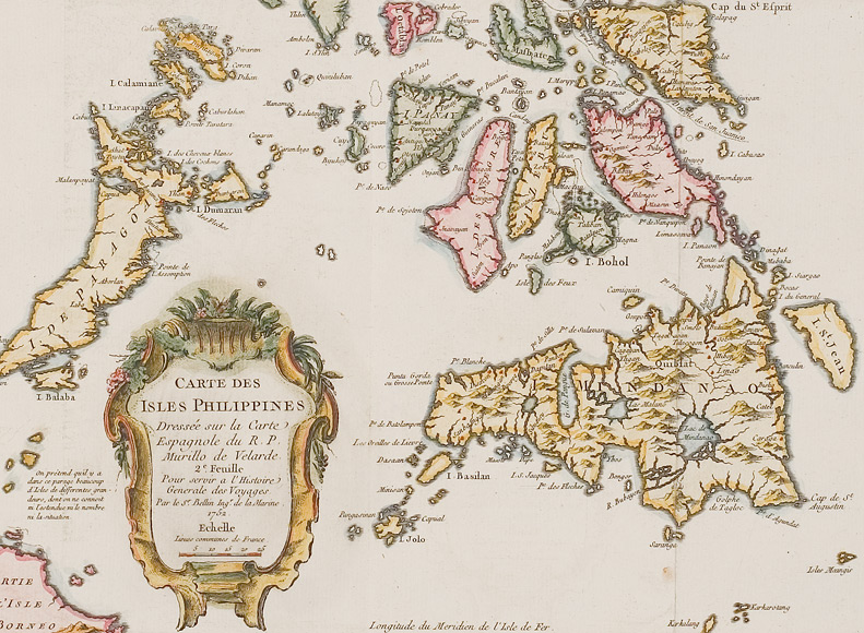
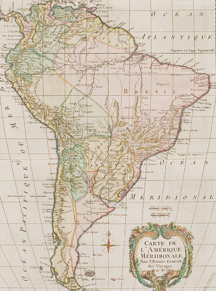
We are offering 25 decoratively coloured copper engraving maps by von Jacques-Nicolas Bellin.
They come out of the works "Histoire universelle, depuis le commencement du monde jusqu'à présent" (Amsterdam / Leipzig, about 1750, different authors) as well as "Abrégé de l'histoire générale des voyage" by J.F. de La Harpe (Paris, about 1780). Most of the present maps have also been used in the 15-volume "Histoire Generale des Voyages" (Paris, about 1750) by Antoine Francois Prevos.
Jacques-Nicolas Bellin (1703 – 1772) was a French hydrographer and cartographer.
In 1721, aged 18 he was appointed hydrographer of the French Navy, a function which he held up to his death.
Never having travelled himself, Bellin systematically collected an extensive amount of information supplied to him by travellers and seafarers. By means of this information he created a substantiated, detailed compilation of the geographical knowledge of his time. This enabled him to produce not only sea charts and maps of countries or continents but also very detailed regional maps, like one of Kamchatka or of several river mouths.
From 1737 on Bellin at first created sea charts but soon also maps of all parts of the world, up to 1762 altogether 59 maps. In 1763 his atlas "Neptune français" was published, depicting all coasts of France. In 1756 his "Hydrographie françoise" was printed, dealing with the oceans of the whole world. In 1764 the 5–volume "Petit Atlas maritime" was published on orders of the French Navy general Choiseul.
Apart from his maps, Bellin also published several geographical books, among others on North America, the Antilles and the British Isles as well as "Nouvelle méthode pour apprendre la géographie" (1769), a geographical handbook for the young. Bellin’s maps also illustrated several travelogues like "Voyage autour du monde" (1771) by Bougainvilles and "Histoire Generale des Voyages" (from 1746 on) by Prevost.
Besides his works as cartographer or geographer Bellin was also involved in the creation of a 35-volume encyclopaedia which was edited by Denis Diderot and Jean le Rond d'Alembert.
Bellin set a high standard regarding craftsmanship and accuracy. With his work e contributed to France’s leading role in the European cartography of the 18th century. Many of his maps became copied by other cartographers.