In December Antiqua does not present a cartographer but an important printing house of maps: Homann Heirs. In 1750 Homann Heirs published the “Altas Silesiae”, containing detailed large copper engraving maps of Silesia which we would like to offer you this month.
The origin of the publishing house was the printing press of Johann Baptist Homann (1664-1724), a famous German cartographer, publisher and engraver. It was founded in 1702.
After the death of J.B. Homann the company was taken over by his son Johann Christoph Homann. He continued printing the maps of his father but soon started to publish under his own name town maps, regional and territory maps. These maps were very similar to those of his father, however, the effort was obvious to produce maps that were more scientific.
In 1730 J.C. Homann died at the age of 27 passing the company to his brother-in-law Johann Georg Ebersberger and to his former fellow student Michael Franz. They were continuing the company under the name „Homännische Erben / Homanni Heredes“ (Homann Heirs).
While Ebersberger took over the technical leadership, Franz started to look for famous employees in order to improve the maps and atlases. So Johann Matthias Hase, Georg Moritz Lowitz, Tobias Mayer and Johann Gabriel Doppelmayr started to work for Homann Heirs, the latter one publishing his famous » Atlas Coelestis containing splendid celestial maps.
In 1760 the publishing house owned a stock of 550 engraved maps, the majority of which were works by J.B. and J.C. Homann. Nevertheless, J.H. Hase and T. Mayer contributed to a strong increase of the number of maps offered and their improvement.
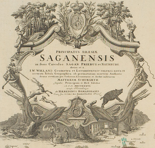
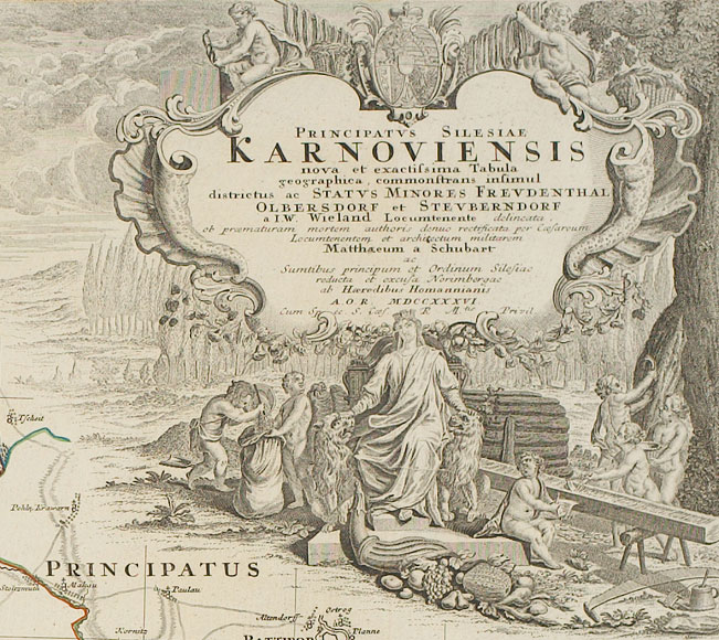
Hase provided the maps with a graticule, starting in 1736 with the maps of Silesian princedoms by Johann Wolfgang Wieland and Matthäus von Schubarth which are those maps that we are offering here.
From 1746 on, new territory maps were published as well as wall maps, geographical books, travelogues and small terrestrial and celestial globes.
Johann Michael Franz retired in 1755 passing his shares to his younger brother Jacob Heinrich Franz.
Ebersberger died in 1760 bequeathing his shares to his daughter who married the book seller Georg Peter Monath who then led the company together with J.H. Franz.
New regional maps broadened the stock of the publishing house, for instance maps of Bohemia, Austria, Switzerland and the Netherlands. Despite of this, the enterprise failed to retain the dominating position which it once had on the field of map publishing. New publishing companies had been founded for instance in Berlin, Gotha, Weimar and Vienna which sold maps with increasing success.
In 1804 the company was taken over by Christoph Franz Fembo who ran it under the name ”Privilegierte Kunst- und Landkarten-Handlung Christoph Fembo (vormals Homann Erben)“ from 1813 on. Fembo reprinted some of the atlases he had taken over but soon the publishing house gradually turned into a map shop.
In 1853 the company was finally abandoned – one of the most important, European cartographic publishing houses had ceased to exist after 150 years.