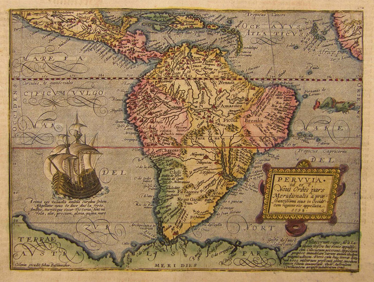
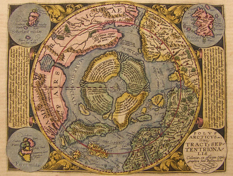
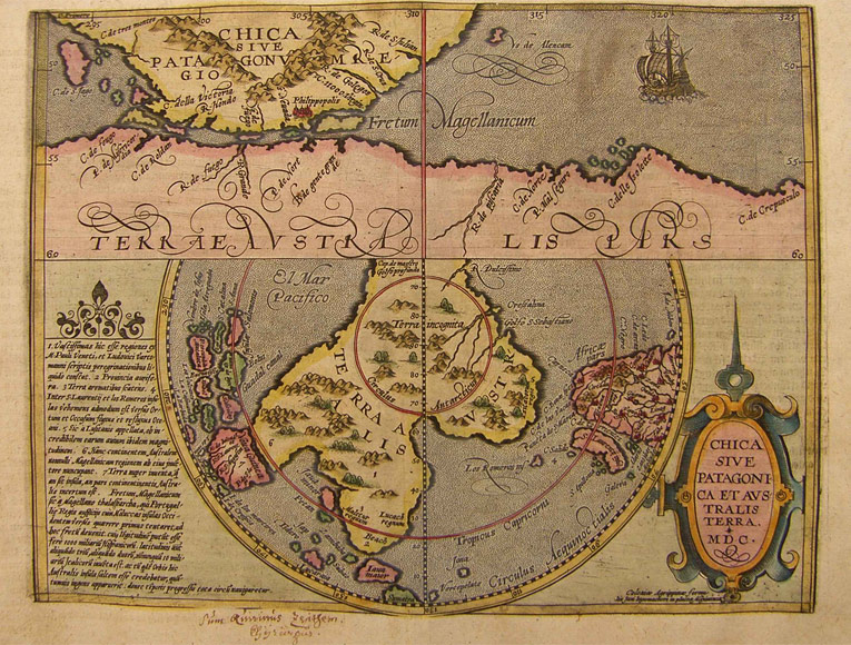
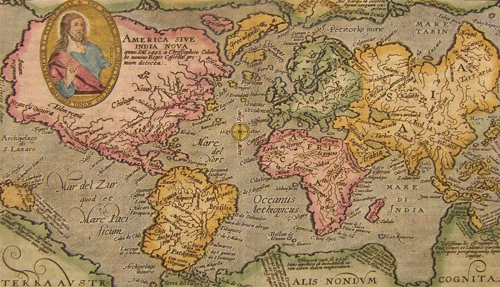
We are presenting 30 rare, decoratively coloured copper engraving maps by Matthias Quad from his Geographisch Handtbuch (Cologne, Johann Bussemacher, 1600), the first world atlas by Quad.
Matthias Quad (1557 in Deventer – 1613 in Eppingen) was a Dutch-German geographer, cartographer and engraver. He also had the surname „von Kinckelbach“.
Quad at first learned at the goldsmith Hendrik Frisians. After that he was apprentice at the engravers Van Doetechem and Hendrik Goltzius.
In 1587 Quad settled in Cologne where he worked as author and cartographer. He met several other Dutch cartographers and engravers who were emigrated as Protestants to the more tolerant Cologne, among them Crispijn van de Passe, Simon van den Neuvel (Novellanus), Pieter Maes and Franz Hogenberg.
Soon a close cooperation developed with Johann Bussemacher, an engraver and publisher from Cologne.
In 1592 Quad published with Bussemacher Europae totius orbis terrarum, an atlas of Europe which he extended to a world atlas within the following years. This atlas with maps of the whole world was published with Bussemacher in 1600, titled Geographisch Handtbuch.
The cartographic work of Quad was noticeable influenced by Gerard Mercator, Abraham Ortelius und Gerard de Jode. However, Quad developed an own style, quite distinct from that of other cartographers of the time.
In 1609 Quad also with Bussemacher published a book on German artists titled Teutscher Nation Herrlichkeit.
Full title of the atlas out of which the present maps are coming:
"Geographisch Handtbuch. In Welchem Die Gelegenheit Der Vornembsten Lantschafften Des Gantzen Erdtbodems in Zwei Und Achtzig in Kupffer Geschnittenen Taffeln Fugebildt. Mit Beygefugter Notwendiger Beschreibung Und Auslegung Derselben... Zugericht Durch Matthis Quaden Kupfferschneider Coln Am Rein Bey Iohan Buxemacher Kundstdrucker".
All maps have got German text printed on the backside. The leaf size is about 35 x 27 cm.
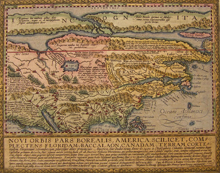
The probably most outstanding map of the ones presented here is Novi Orbis Pars Borealis, one of the first maps showing North America separately. The unusual depiction was derived from the respective map by Gerard de Jode.