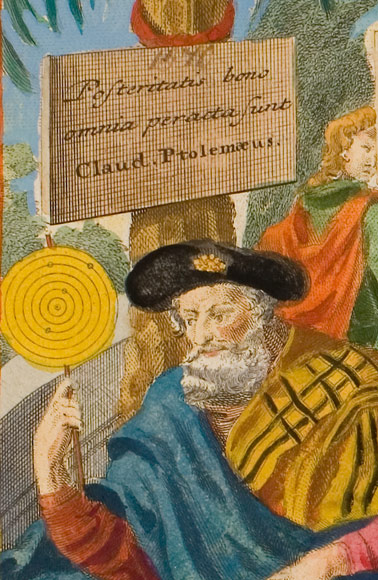
The Ptolemy Rome Edition of 1478 AD
[Cosmographia. Rome: Arnold Buckinck, successor of Conrad Sweynheym, 10th October 1478]
It is the third edition of the work and the second which includes maps.
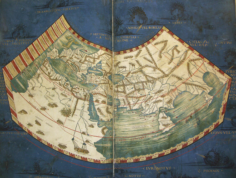
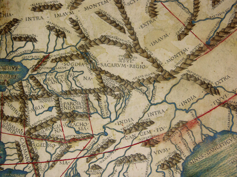
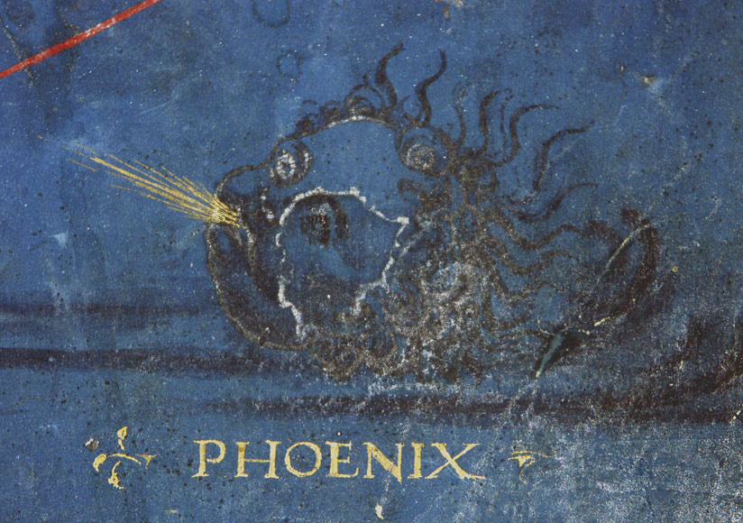
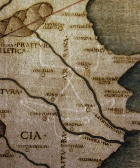
We are presenting 18 incunable maps out of it in beautiful old-colouring.
The maps are among the earliest copper engravings ever printed.
The first edition of the Cosmographia had been published at Vicenza in 1475 without illustrations. The first edition including maps appeared in 1477 at Bologna. Further editions which made use of the original plates of the 1478 edition, had been printed at Rome in 1490 (at Petrus de Turre) and in 1507 (at Bernhardinus de Vitalibus)
It is proved that Columbus owned an exemplar of the 1478 Rome Edition which served as one of his sources for preparing his upcoming expeditions. The maps of Ptolemy solidified the navigator's belief that the fastest route from Europe to the Indies was to sail directly west across the Atlantic, which as is known led to the discovery of America.
The 1478 edition of Ptolemy is an absolute rarity in threefold respect. It is an important work of early book printing, of early printed cartography and of early copper engraving.
The story of the genesis of the edition is highly fascinating too. It begins with Conrad Swenheym, who is widely thought to have been present at the birth of printing while an apprentice of Johannes Gutenberg. After Mainz was sacked in 1462, Swenheym fled south to Italy and arrived at the Benedictine monastery of Subiaco. In 1464-5, Swenheyn introduced the first printing press to Italy, in partnership with another German émigré, Arnold Pannartz. From 1467 on both printed in Rome more than 50 titles.
In 1474 the German printers started the creation of the first printed illustrated edition of Ptolemy's Cosmographia, a work which was one of the greatest sensations of the Italian Renaissance. Soon this immensely challenging endeavour was well under way, and Swenheym is recorded as having himself trained his assistants in the still young technique of copper engraving. The Ptolemy manuscript of a German Benedictine from about 1460 served as master for drawing the maps.
However, Sweynheym soon had competition in the form of Taddeo Crivelli of Bologna, who was determined to be the first to the goal, even allegedly enticing one of Swenheym's close employees. Crivelli raced to complete the project, while Swenheym carefully guided the quality of his work, an endeavour slowed by the death of Pannartz in the plague of 1476. Crivelli's work was finally published on June 29th, 1477, making it the first printed Cosmography and the first ever set of engraved maps. Swenheym died in 1577, and the project was taken up by Arnold Buckinck, originally from Cologne, who led the project to completion on 10 th October 1478.
While it may not have been the first printed edition, Rodney Shirley notes that 'The copper plates engraved at Rome ... [were] much superior in clarity and craftsmanship to those of the 1477 Bologna edition ... Many consider the Rome plates to be the finest Ptolemaic plates produced until Gerard Mercator engraved his classical world atlas in 1578' (Shirley p.3).
Raleigh A. Skelton states 'The superior craftsmanship of the engraved maps in the Rome edition, by comparison with those of the [1477] Bologna edition, is conspicuous and arresting. The cleanliness and precision with which the geographical details are drawn; the skill with which the elements of the map are arranged according to their significance, and the sensitive use of the burin in working the plates - these qualities ... seem to point to the hand of an experienced master, perhaps from North Italy' (Skelton, p.VIII). A number of authorities have suggested a principal engraver from either Venice or Ferrara.
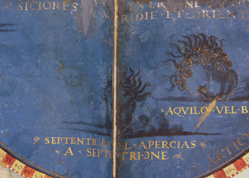
Another outstanding feature of these maps is the fine Roman letters used for the place names on the plates. In an apparently unique experiment, these letters were not engraved with a burin but punched into the printing plate using metal stamps or dies.
A further unusual aspect is that the maps were printed on 2 sheets which later became joined in the middle.
These fine prints represent a milestone in the medium, being some of the earliest successful gravure printings, quite apart from their undeniable cartographic importance.
The artists who carried out Swenheym's vision have produced the probably most important and artistically virtuous printed maps of the fifteenth-century. Upon the publication of the Rome Ptolemy, a frustrated Crivelli saw potential clients abandon his edition in favour of its superior rival.
The maps presented here are doubtlessly among the most impressive and historically most valuable cartographic images of the world.
Lit.: Shirley, The Mapping of the World, p. 4; Skelton, Claudius Ptolomaeus Cosmographia Rome 1478 (Amsterdam, 1966), p. XIII